
Maps and Globes
Aligned to C3.D2.Geo.1 — C3 Framework for Social Studies State Standards.
What this lesson teaches
A map is a flat picture of a place, and a globe is a round model of our whole Earth.
Worked example
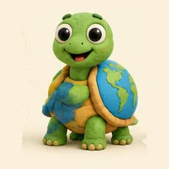
On a globe, the blue parts show water and the green and brown parts show land.
Practice questions
- Tell what color shows water on a globe.
- Draw a simple map of your bedroom.
- Point to where you live on a map with a grown-up.
Watch the lesson
Every lesson comes with a video taught in English and Spanish — the same video the QR code in the printed workbook opens.
▶ Watch this lessonEn español
Mapas y Globos Terráqueos
Un mapa es un dibujo plano de un lugar, y un globo terráqueo es un modelo redondo de toda nuestra Tierra.
Ejemplo: En un globo terráqueo, las partes azules muestran el agua y las partes verdes y cafés muestran la tierra.
More Geography lessons
Teach this lesson today
An AI tutor that guides with questions instead of just giving answers — all K–12 core subjects, every child in the family.
Start free — no card required